
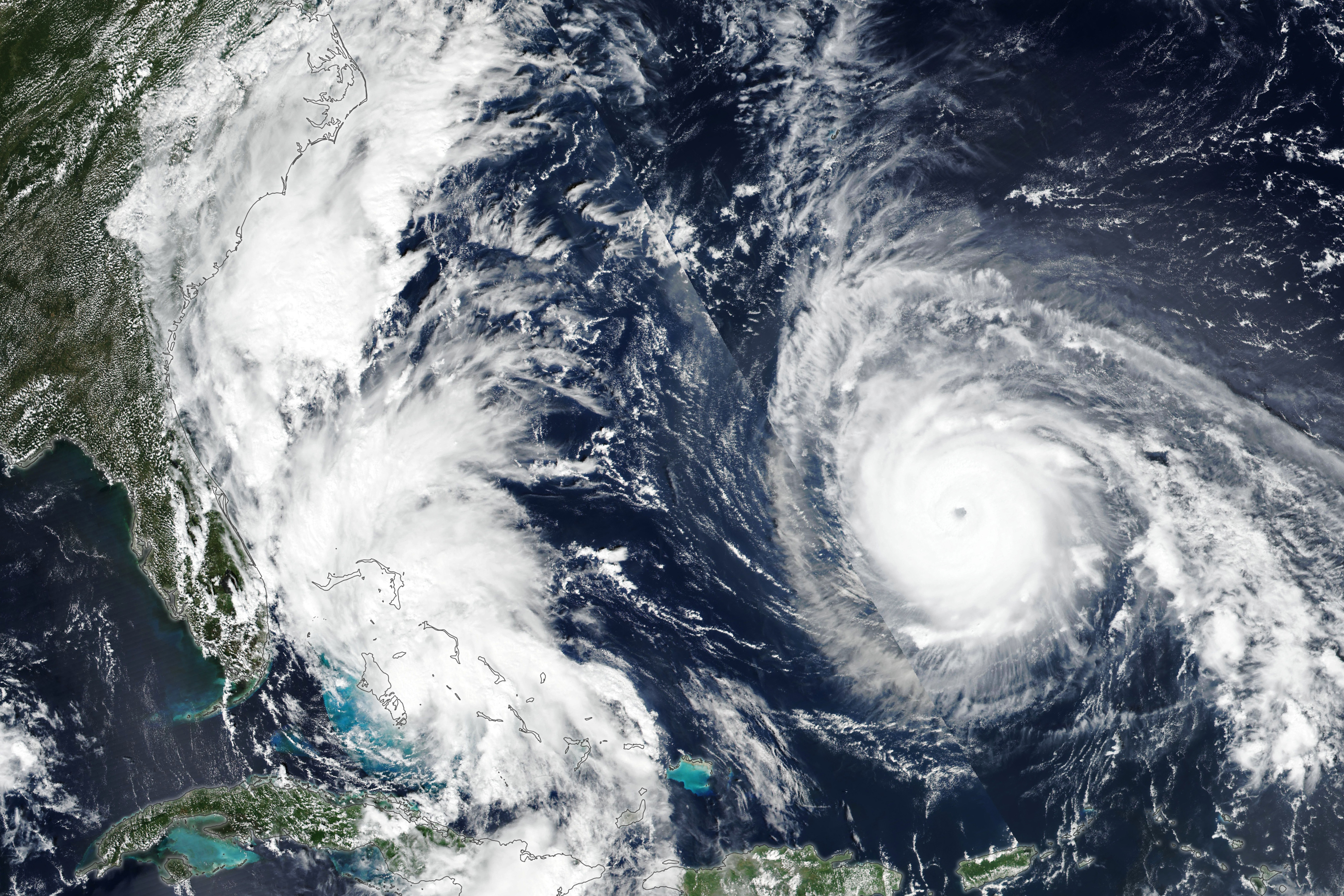
This week’s image comes from NASA’s Earth Observatory. It caught two tropical cyclones stirring up the Atlantic Ocean in late September. Both Tropical Storm Imelda and Hurricane Humberto caused plenty of problems off of the east coast of the United States without ever making landfall.
Here is more on the two storms from NASA:
Imelda had already brought tropical storm conditions to portions of the central and northwestern Bahamas. Prior to becoming a named storm, the system also lashed Puerto Rico and eastern Cuba with heavy rain. In the coming days, Imelda could intensify and cause flash and urban flooding along the coast of the Carolinas, according to the National Hurricane Center.
Although Humberto lurked farther from land, its effects still reached coastlines due to its massive size. Dangerous surf conditions affected beaches in the northern Caribbean, the Bahamas, and Bermuda, as well as much of the U.S. East Coast. Mid-Atlantic and even some Northeast states could see large swells and rip currents stemming from the storm, forecasters warned.
